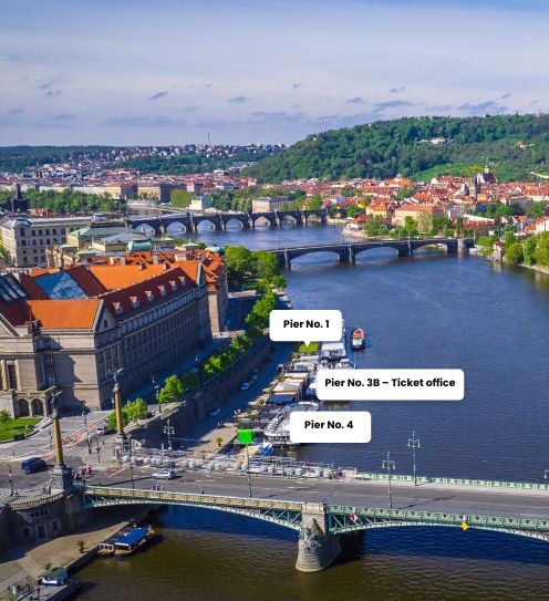
Rašín Embankment
You will find Rašín Embankment on the right bank of the Vltava River. It consists of a sequence starting with the Vyšehrad tunnel, through Výtoň, where it crosses the Railway Bridge over to Palacký Square ending at the Palacký Bridge.
In addition to transport the so-called náplavka – the pedestrian zone – runs along most of its space. On the waterfront there is a marked cycle route and it also serves as a great walking promenade. Here, you will find several docks for cruise boats. It also regularly hosts farmers markets where you can buy products from the Czech farmers. The waterfront is also a thoroughfare to the operation of trams and cars. The length of the waterfront is roughly 950 m.
During its existence Rašín Embankment bore different names (e.g. Podskalské Embankment from 1919 to 1924, Vltavské Embankment from 1940 to 1942, Reinhard Heydrich Ufer 1942-1945, and Frederick Engels Embankment 1951-1990) and was divided into different sections.
The section from Palacký Square to Jirásek Square was rebuilt in an embankment in the 70s in the 19th century and was first named Palacký waterfront. The section from the Vyšehrad rock to Palacký Square was rebuilt into an elevated embankment in the early 20th century and it was first named Vyšehradské Embankment. In 1990, the two parts merged under the name Rašín Embankment.
When taking one of our longer cruises along the Rašín Embankment you can see a wide range of Prague's landmarks, such as the Dancing House or Podskalská customs house on Výtoň. You can also find in our animation about the destinations of our ships and steamers.


